Across Europe, some of the continent’s most dramatic landscapes lie outside its best-known national parks and busiest tourism hotspots. These destinations range from volcanic highlands and Atlantic islands to mountain ridges and coastal trails, offering expansive views and hiking terrain while remaining quieter than many of Europe’s classic outdoor destinations.
Brandnertal Valley, Austria
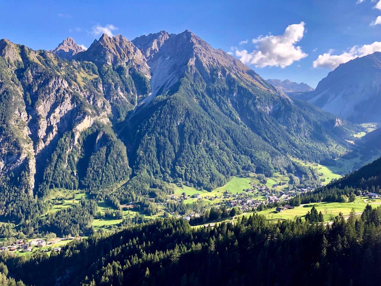
Brandnertal is an Alpine valley in Austria’s western state of Vorarlberg near the borders with Switzerland and Liechtenstein, framed by the peaks of the Rätikon range. Hiking trails cross alpine meadows, forests, and higher mountain terrain, with routes leading to Lünersee, a turquoise lake surrounded by jagged peaks, including the distinctly shaped Schesaplana. Cable cars provide access to higher elevations and panoramic viewpoints above the valley floor.
Coastal Trails of Brittany, France
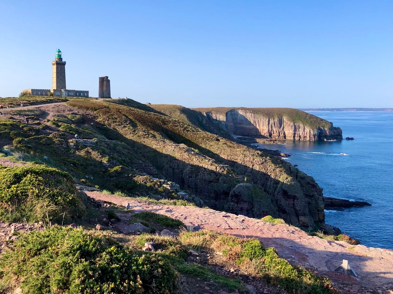
The GR34 long-distance trail traces Brittany’s rugged coastline and is known as the Sentier des Douaniers, or Customs Officers’ Path. Built in the late 18th century to patrol the coast against smuggling, the route now runs along much of the region’s shoreline. Sections pass cliffs, moorland, and lighthouses such as those at Cap Fréhel on the Emerald Coast, where the coastline rises high above the Atlantic.
Bohemian Switzerland, Czech Republic
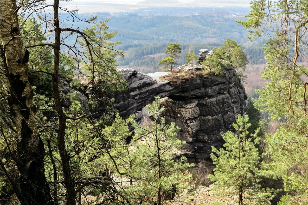
Bohemian Switzerland near the German border protects a landscape of sandstone cliffs, forested valleys, and river gorges. One of its best-known natural features is Pravčická brána, considered the largest natural rock arch in Europe. Trails connect viewpoints such as Belvedere, which overlooks the Elbe River canyon far below.
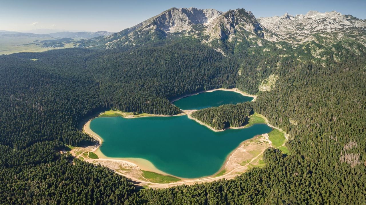
Durmitor, Montenegro
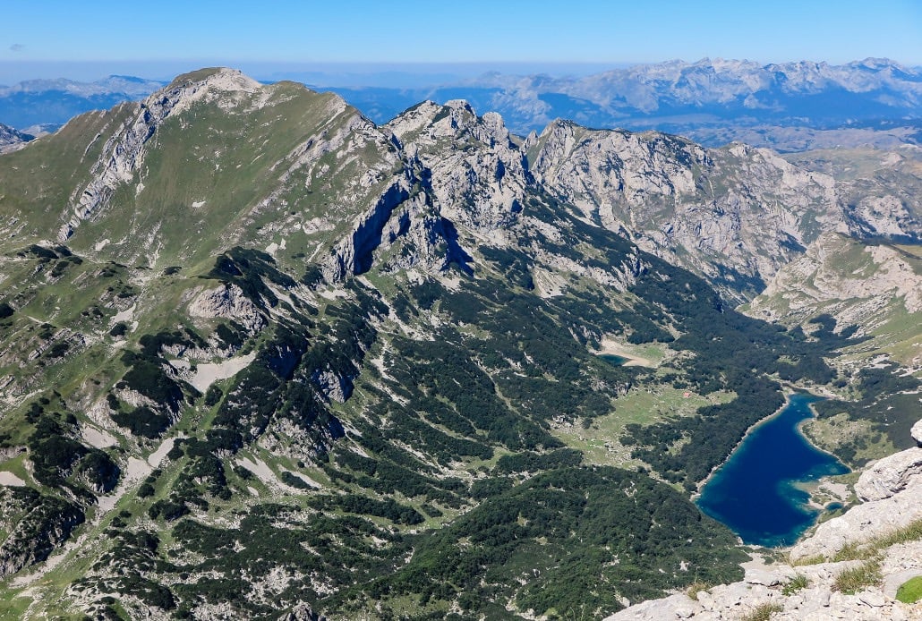
In northern Montenegro, Durmitor centers on a rugged massif of limestone peaks rising above deep canyons and glacial lakes. The area includes Tara Canyon, often cited as one of Europe’s deepest river gorges, as well as alpine lakes known locally as “mountain eyes.” Trails cross high plateaus and pine forests toward peaks rising above 8,200 feet.
Transfăgărășan Highway, Romania
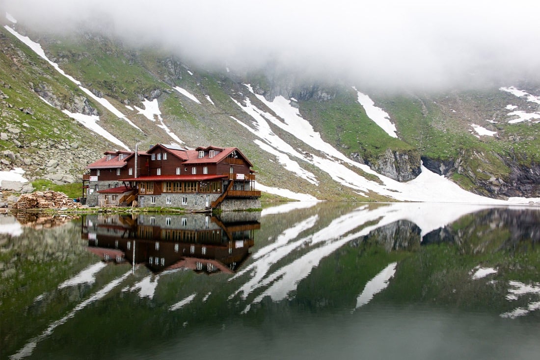
The Transfăgărășan Highway crosses the Făgăraș Mountains in Romania’s Carpathian range. Completed in the early 1970s, the roughly 55-mile road climbs to about 6,700 feet (2,042 meters) through a series of hairpin turns, tunnels, and viaducts. Notable stops include Vidraru Lake and the glacial Balea Lake near the highest point of the pass.
Snæfellsnes Peninsula, Iceland
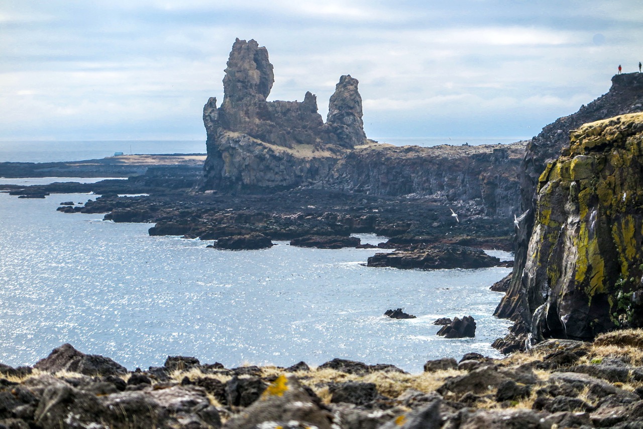
West of Iceland’s mainland, the Snæfellsnes Peninsula brings together several of the island’s landscapes within a compact area. The peninsula is anchored by the Snæfellsjökull glacier-capped volcano, rising above lava fields, coastal cliffs, and black-sand beaches. Fishing villages, sea stacks, and bird-filled cliffs line the shoreline, while trails run through the surrounding national park.
Auvergne, France

Volcanic landscapes define France’s Auvergne region in the Massif Central. The area includes the Chaîne des Puys, a chain of dormant volcanoes stretching west of Clermont-Ferrand. Peaks such as Puy de Dôme and Puy de Sancy overlook trails passing volcanic craters, forested slopes, and lakes formed by past eruptions.
Besseggen Ridge, Norway
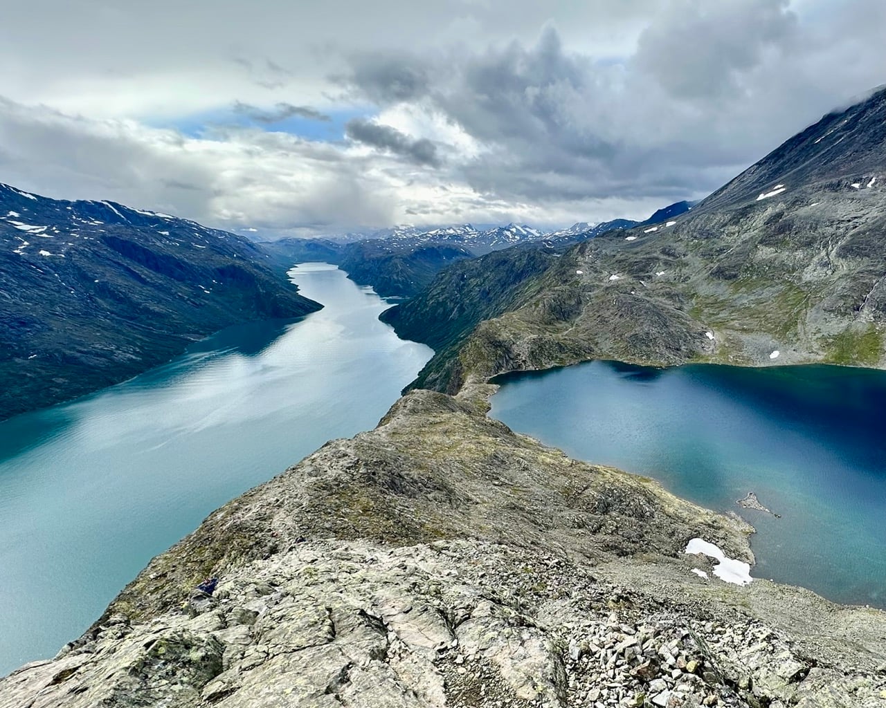
In Norway’s Jotunheimen mountains, Besseggen Ridge runs between the lakes Gjende and Bessvatnet. The narrow ridge offers views of both lakes, whose surfaces sit hundreds of feet apart in elevation and appear strikingly different in color. The hike follows the ridge to Veslfjellet, the high point of the route.
Theth, Albania
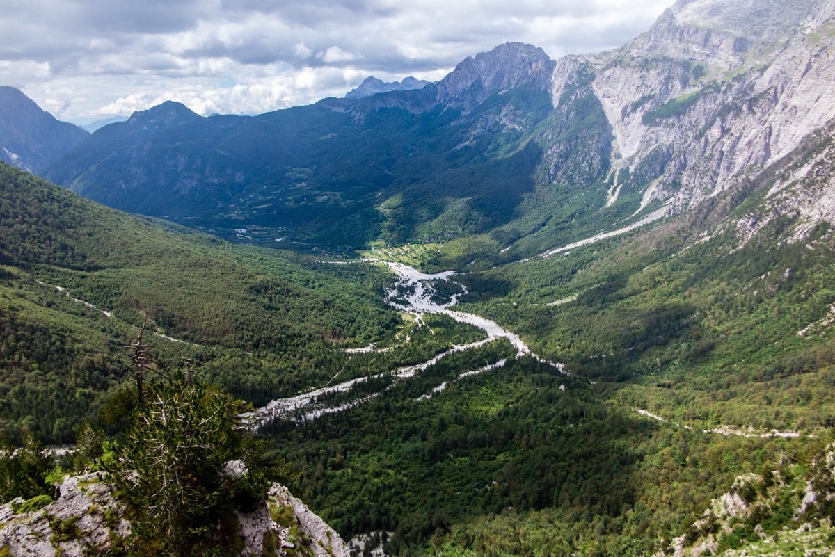
In northern Albania’s Albanian Alps, Theth lies about 45 miles northeast of Shkodër near the border with Montenegro. The protected area includes steep valleys, limestone peaks, and dense forests surrounding the small village of Theth. Trails lead toward mountain passes with views of the region’s highest peak, Maja Jezercë, which rises to about 8,800 feet (2,694 meters).
Rila Mountains, Bulgaria
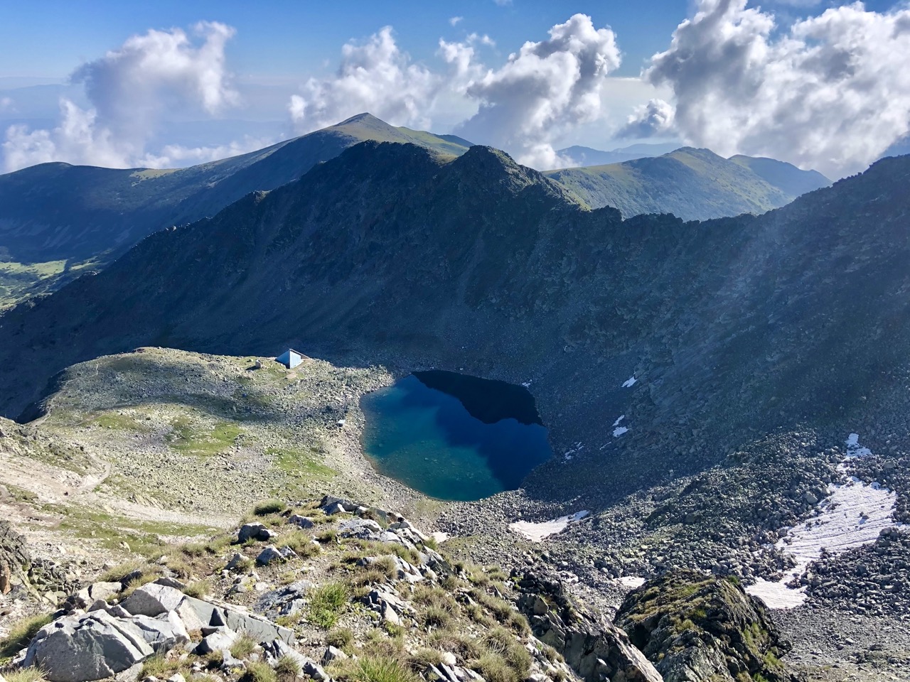
Bulgaria’s Rila Mountains contain some of the highest terrain in the Balkans, with sharp peaks, glacial valleys, and alpine lakes scattered across the massif. The range is also home to Mount Musala, the highest peak in Bulgaria and the Balkan Peninsula, rising to about 9,600 feet (2,925 meters).
Aigüestortes i Estany de Sant Maurici, Spain
In the central Pyrenees of Catalonia, Aigüestortes i Estany de Sant Maurici contains more than 200 glacial lakes scattered among granite peaks, forested valleys, and alpine meadows. One of its best-known landmarks is the twin-peaked mountain, Els Encantats, rising above Lake Sant Maurici.
São Miguel, Azores, Portugal
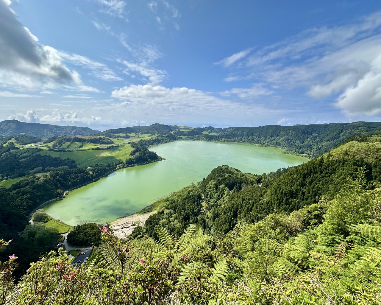
São Miguel, the largest island in Portugal’s Azores archipelago, is shaped by volcanic landscapes that include crater lakes, steep coastal cliffs, and forested ridges. Natural areas include the caldera of Sete Cidades with twin crater lakes and Lagoa do Fogo, a volcanic lake formed after a 16th-century eruption. Trails cross the island’s highlands, including the hike to Pico da Vara, the island’s highest peak.