There’s something primal about crossing a massive bridge that makes even the most sensible sedan driver feel like they’re piloting a land yacht through uncharted waters. Maybe it’s the engineering marvel beneath your wheels, the endless views that make your GPS question its life choices, or simply the fact that you’re essentially driving on a road that shouldn’t exist according to basic physics.
Whatever it is, these bridges transform mundane point-A-to-point-B drives into the kind of experiences that make you forget about your fuel economy for a few glorious miles.
We’ve assembled the 10 longest bridges you can actually drive across without needing a commercial license or a PhD in marine engineering. From Florida’s tourist magnet to China’s industrial titans, these spans offer everything a driving enthusiast could want: impressive statistics to bore your friends with, stunning photography opportunities for your social media, and the unique joy of watching your car’s thermometer while surrounded by water on all sides.
So grab your favorite road trip snacks, check that your air conditioning works, and prepare to discover why some of the world’s best drives don’t actually touch land for miles at a time.
How We Chose the Bridges: Our Road Trip Research Method
Creating this list required more detective work than finding a gas station with decent prices these days. We searched the internet to identify bridges that combine jaw-dropping length with actual public access (because apparently, some engineers build 20-mile bridges and then decide regular drivers can’t handle them).
Our criteria were simple: it had to be long enough to make you question your fuel range, accessible to anyone with a valid license and questionable life choices, and interesting enough to justify the inevitable toll fees. We excluded rail-only bridges (sorry, train enthusiasts), private or restricted-access spans, and anything that required special permits; though we’re pretty sure some of these bridges should come with a psychological evaluation requirement.
Each bridge earned its spot not just for length, but for the complete driving experience: scenery that makes you forget you’re technically commuting, engineering that makes you appreciate human stubbornness, and that special feeling of being suspended over water while your car’s warranty slowly expires beneath you.
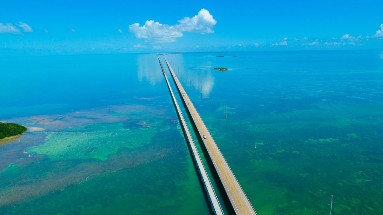
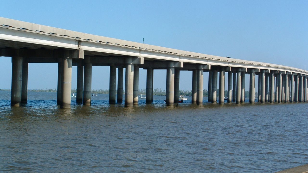
Seven Mile Bridge, Florida Keys, USA: 7 Miles
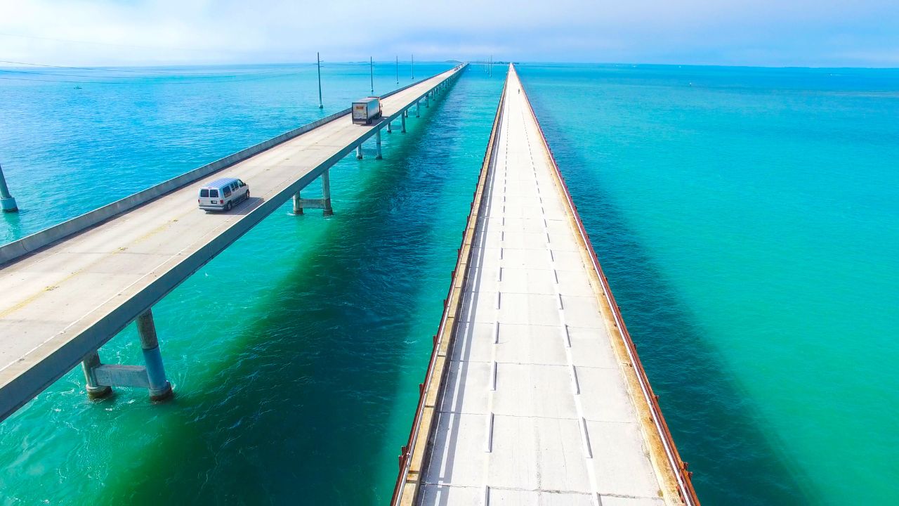
Let’s start with the bridge that’s practically Florida’s unofficial mascot, despite being slightly shorter than its name suggests. Because nothing says “Florida marketing” like rounding up. At 6.79 miles, the Seven Mile Bridge connects Knight’s Key to Little Duck Key along the Overseas Highway, serving as the backbone of one of America’s most beautiful and slightly unhinged road trips.
Built in 1982 to replace the original 1912 railroad bridge (which apparently thought trains were the future), this concrete beauty carries about 2.5 million vehicles annually over 65-foot-high spans. The bridge is built from precast, prestressed concrete and comprises 440 spans and was designed for extreme hurricane exposure and marine conditions, because Mother Nature has strong opinions about Florida infrastructure.
For drivers, it’s pure sensory overload: turquoise waters that make your car’s paint look dull, fishing boats that make you question your career choices, and enough Instagram opportunities to crash your data plan. The experience is so iconic that Hollywood has used it as a backdrop for everything from action movies to car commercials, though they rarely mention there’s no toll today, the Overseas Highway has been toll-free since the 1950s.
Pro tip: The old bridge runs parallel and serves as a fishing pier, so you can see exactly what you’re driving over while contemplating the engineering confidence required to build something like this in hurricane country.
Confederation Bridge, Prince Edward Island, Canada: 8 Miles
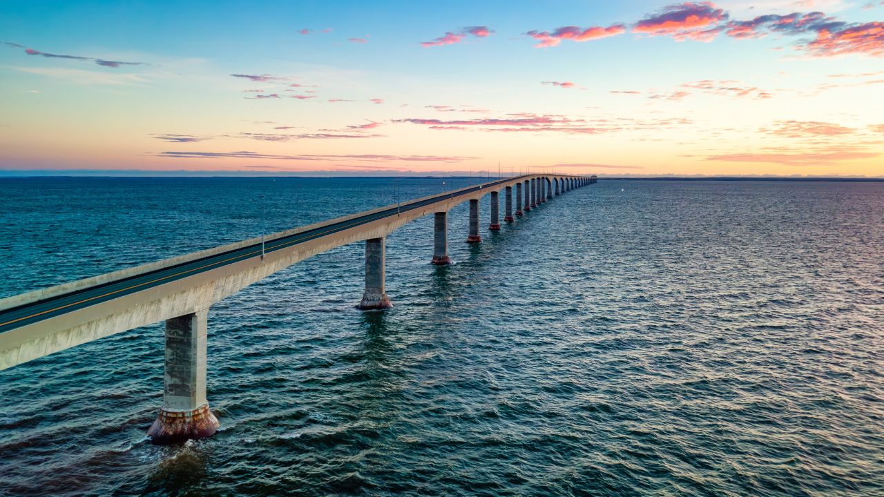
At eight miles long, the Confederation Bridge proves that Canadians can build something impressive without apologizing for it. This engineering marvel connects Prince Edward Island to mainland New Brunswick, ending the island’s complete dependence on ferries and giving residents the freedom to drive to Tim Hortons whenever they want.
Opened in 1997 after four years of construction and decades of political debate, the bridge was built to survive everything the Northumberland Strait could throw at it: ice floes and complex tides (the Northumberland Strait’s tidal range is on the order of ~1–2 meters, depending on location), and weather that would make a snowplow cry. The structure sits on 44 piers spaced 820 feet apart, with a main span clearance of 195 feet: high enough for cruise ships but low enough to keep your acrophobia manageable.
The bridge features a gentle 8-kilometer curve designed to reduce driver fatigue and provide constantly changing views, though the real reason might be to make the crossing last longer so you appreciate the toll (charged when leaving PEI), currently listed at C$20 for a two-axle car, though rates have changed over time The bridge is a multi-span post-tensioned concrete box-girder design that can flex with temperature changes of up to 100°F, making it more adaptable than most relationships.
For drivers, it’s a surprisingly zen experience, no dramatic ocean swells, just steady views of the Gulf of St. Lawrence and the gradual realization that you’re crossing ice-covered water for most of the winter. The bridge carries about 1.8 million vehicles annually, proving that even Canadians occasionally need to leave paradise.
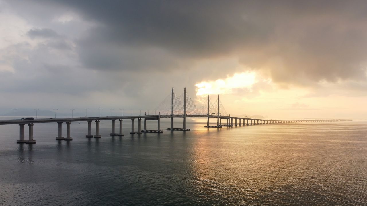
Penang Second Bridge, Penang, Malaysia: 15 Miles
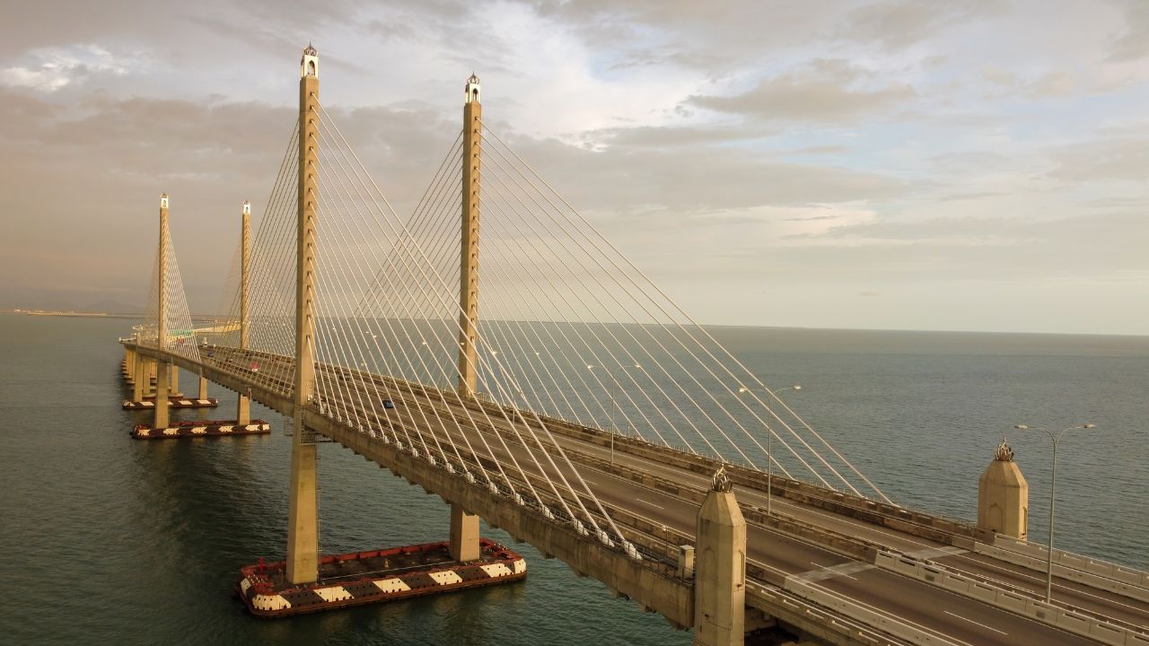
The Sultan Abdul Halim Muadzam Shah Bridge (yes, that’s its full name, and yes, everyone just calls it the Second Bridge) stretches 14.9 miles across the Penang Strait, making it Southeast Asia’s longest bridge and proof that Malaysia doesn’t mess around with infrastructure projects.
Completed in 2014 after five years of construction, this cable-stayed beauty features a cable-stayed main span of 475 meters (1,558 feet) with towers reaching 300 feet above sea level. The bridge was built using balanced cantilever construction: basically, they built it from both ends and met in the middle, which sounds like a metaphor for international relations but is actually just efficient engineering.
The structure includes 4.8 miles of approach viaducts and carries six lanes of traffic with posted speed limit of 80 km/h (about 50 mph) on the bridge, though local drivers have their own interpretations of speed limits. The bridge was designed to handle 80,000 vehicles daily, reducing mainland-to-island travel time from 30 minutes to 10 minutes, assuming you don’t get stuck behind a tour bus taking photos.
For driving enthusiasts, it’s all about the views: the Andaman Sea stretches endlessly on one side while Penang’s skyline grows larger on the other. The gentle curves and consistent grade make it a smooth, almost meditative drive, especially at sunrise when the water reflects every color your camera can’t quite capture. The RM8.50 toll is practically pocket change compared to what you’d pay for similar views anywhere else.
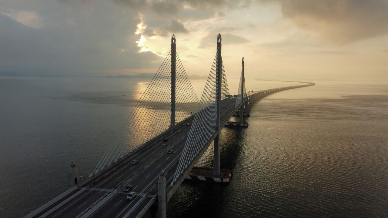
Jiaozhou Bay Bridge, Qingdao, China: 16.6 Miles
China’s Jiaozhou Bay Bridge proves that when the Chinese decide to connect two points, they don’t mess around with ferry schedules or weather delays. This 16.6-mile concrete giant connects Qingdao to Huangdao District, slashing commute times from 45 minutes to 20 minutes and giving drivers some of the most expansive ocean views in Asia.
Opened in 2011 after four years of construction, the bridge used roughly 450,000 tons of steel and 2.3 million cubic meters of concrete, enough material to make your weekend DIY project look absolutely pathetic. Its largest navigational span measures about 260 meters (≈850 feet), providing clearance for major commercial shipping traffic crossing Jiaozhou Bay, because apparently Chinese maritime logistics doesn’t believe in small boats.
The engineering specs read like a fantasy novel: the bridge was designed to withstand 8.0-magnitude earthquakes, designed to withstand severe earthquakes, typhoons, and ship collisions. Construction used about 450,000 tons of steel and 2.3 million m³ of concrete, and the bridge is supported by 5,238 concrete piles, making it more complex than most people’s relationships and significantly more reliable.
For drivers, the experience is pure theater: endless ocean views broken by passing container ships that make your SUV look like a toy car. The bridge integrates with nearby tunnels, creating a unique driving experience where you transition from open-air ocean views to enclosed underwater passages – it’s like a James Bond movie, but with toll booths.
Chesapeake Bay Bridge Tunnel, Virginia, USA: 17.6 Miles
The Chesapeake Bay Bridge-Tunnel is more than a tunnel. It’s a 17.6-mile engineering soap opera that combines soaring spans, underwater tunnels, and enough maritime drama to keep you entertained from Norfolk to the Eastern Shore. This hybrid marvel connects Virginia Beach to Cape Charles, eliminating a 95-mile detour that used to make Virginians question their life choices.
Originally opened in 1964 and expanded with parallel spans through 1999, the CBBT (as locals call it) includes 12 miles of low-level trestle, two one-mile tunnels, two bridges, four artificial islands, and enough concrete to pave a small city. The tunnels reach depths on the order of ~100 feet below the water surface at their deepest points, allowing massive Navy vessels to pass overhead while you’re essentially driving through an aquarium.
The engineering challenges were legendary: builders had to work in 25-foot tides, hurricane-force winds, and water so deep they needed specialized equipment just to find the bottom. The result is a structure that carries 3.7 million vehicles annually while maintaining a safety record that makes airline pilots jealous.
For drivers, it’s a constantly changing experience: you’ll cruise over choppy bay waters on 4.7-mile-long bridges, then plunge into tunnels where the only views are your headlights and the occasional maintenance vehicle. The artificial islands provide rest stops with panoramic bay views and enough photo opportunities to fill your phone’s storage. The $18 toll might seem steep until you realize you’re essentially getting a theme park ride that saves you 90 minutes of driving.
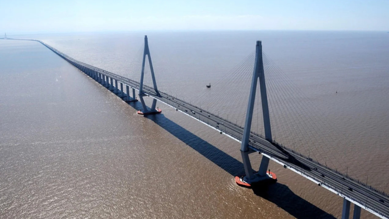
Donghai Bridge, Shanghai, China: 20.2 Miles

Shanghai’s Donghai Bridge stretches 20.2 miles into the East China Sea, connecting the mainland to Yangshan Deep-Water Port with the kind of engineering confidence that makes other countries’ infrastructure projects look like weekend hobbies. This bridges China’s declaration that geography is merely a suggestion.
Completed in 2005 after three years of construction, the Donghai was China’s first major sea-crossing bridge, requiring 440,000 tons of steel and innovative construction techniques that included building sections on land and floating them into position. The bridge features a cable-stayed section with a largest span of 420 meters and enough precast concrete segments to make your local highway project manager weep with envy.
The structure was designed to handle everything the East China Sea could deliver, for severe typhoons, marine corrosion, and seismic conditions: 200-mph typhoon winds, 8.0-magnitude earthquakes, and ship collisions from vessels up to 100,000 tons, because apparently Chinese engineers don’t believe in half-measures. The bridge carries both freight traffic to one of the world’s busiest ports and private vehicles whose drivers want bragging rights for crossing one of Asia’s most impressive spans.
For driving enthusiasts, it’s a front-row seat to global commerce: massive container ships pass beneath while cargo cranes dot the horizon like mechanical giants. The open-water views stretch endlessly, punctuated by seabirds that make your car’s GPS question whether you’ve accidentally driven into the ocean. The experience is especially dramatic during Shanghai’s frequent fog, when the bridge seemingly disappears into clouds while you’re still driving on it.
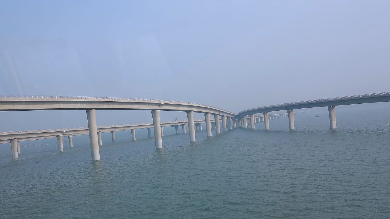
Hangzhou Bay Bridge, Zhejiang, China: 22.2 Miles
Opened in 2008 after nearly a decade of planning and construction, the bridge required 2.5 million tons of concrete and 800,000 tons of steel: enough material to build several small cities, though considerably more stylish. The structure includes a 1,480-foot main span and was designed to last 100 years in some of China’s most challenging marine conditions, including tidal variations of up to 26 feet.
The engineering challenges were immense: builders worked in extremely challenging tidal and marine conditions while contending with typhoons, extreme tides, and shipping traffic that makes Manhattan look peaceful. The bridge features color-coded sections to help drivers navigate the lengthy crossing, because apparently even Chinese GPS systems need help with 22-mile bridges.
For drivers, it’s a lesson in scale and beauty: the graceful S-curve provides constantly changing views while the surrounding seascape stretches to the horizon. The bridge is particularly stunning at sunrise, when the cables and towers cast dramatic shadows over water that reflects every shade of orange and gold your Instagram filters wish they could replicate. The experience is smooth and surprisingly meditative, assuming you don’t think too hard about being suspended 20+ miles from either shore.
Manchac Swamp Bridge, Louisiana, USA: 22.8 Miles
Louisiana’s Manchac Swamp Bridge takes Interstate 55 on a 22.8-mile journey through some of America’s most atmospheric (and slightly creepy) wetlands. This isn’t your typical ocean-crossing experience: instead, you’ll glide over cypress swamps, Spanish moss, and enough Louisiana wildlife to make city drivers question their navigation choices.
Built in 1979 as twin concrete trestle bridges, the Manchac spans were designed to carry heavy interstate traffic while minimizing environmental impact on the delicate wetland ecosystem below. The structures sit on thousands of concrete pilings driven deep into a swamp bottom that’s more liquid than solid – engineering that required techniques usually reserved for offshore oil platforms.
The bridges earned recognition as one of the world’s longest continuous bridges over wetlands/swamp, though “water” might be generous for what’s essentially a living, breathing wetland ecosystem. The twin spans carry about 30,000 vehicles daily through terrain that would challenge an airboat, all while maintaining grades and curves suitable for 18-wheelers doing 70 mph.
For drivers, it’s like cruising through a nature documentary: cypress trees draped in Spanish moss create natural tunnels, while alligators, herons, and the occasional nutria provide wildlife entertainment. The elevated perspective offers views into Louisiana’s swamp country that would be impossible from ground level, assuming there was solid ground to stand on. The experience is especially memorable during fog, when the bridge seems to float through clouds while mysterious sounds drift up from the swamp below.
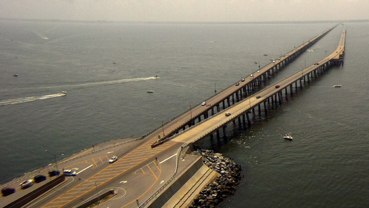
Lake Pontchartrain Causeway, Louisiana, USA: 23.83 Miles
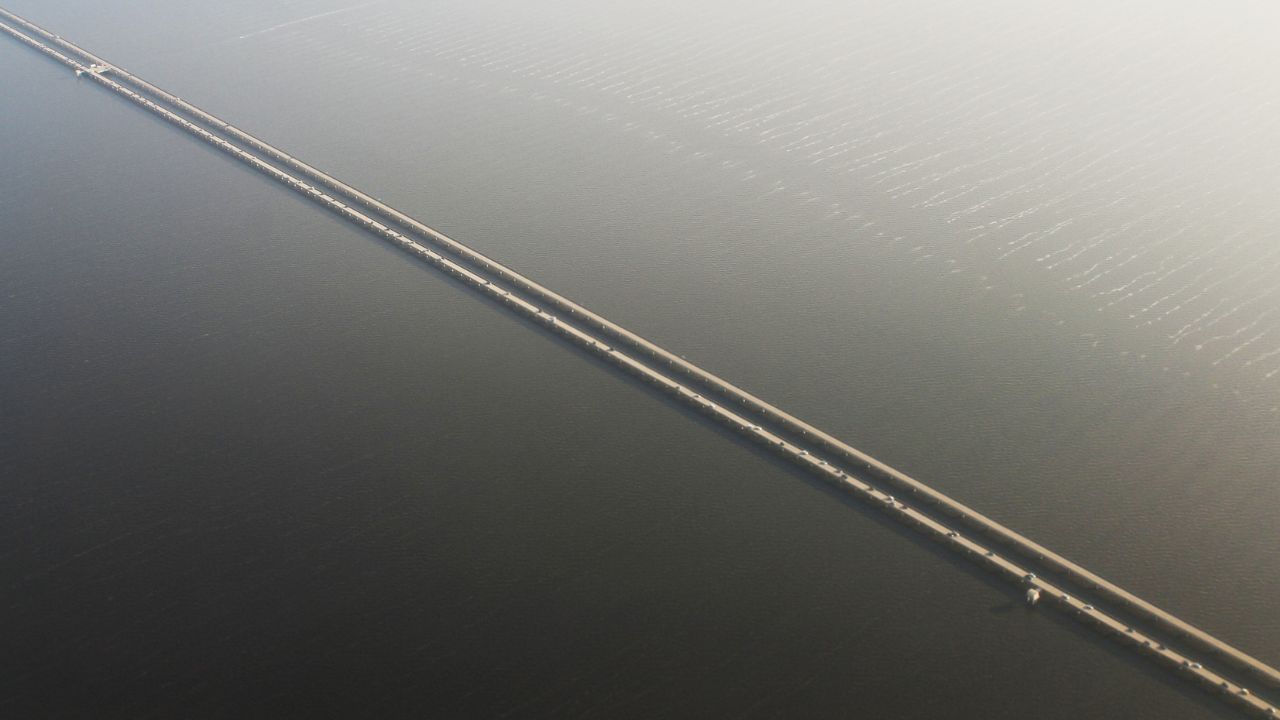
The Lake Pontchartrain Causeway holds the Guinness record for longest bridge over water (continuous), stretching an almost incomprehensible 23.83 miles across Louisiana’s Lake Pontchartrain. This is a 24-mile lesson in human stubbornness and engineering audacity that makes regular bridges look like weekend projects.
Built in two parallel spans (1956 and 1969), the Causeway connects Metairie near New Orleans to Mandeville on the north shore, eliminating a 50-mile drive around the lake. The structure sits on 9,500 concrete pilings and includes two bascule drawbridges that can lift to allow tall vessels to pass; though scheduling your crossing around boat traffic requires planning usually reserved for space missions.
The Causeway Commission operates the bridge like a small country, complete with its own police force, maintenance fleet, and weather monitoring systems. The structure carries about 12 million vehicles annually across water that reaches depths of 65 feet, all while dealing with weather that ranges from hurricane-force winds to fog so thick you can’t see your own hood.
For drivers, it’s a surreal experience that starts normally but gradually becomes otherworldly. About halfway across, both shorelines disappear, leaving you suspended between sky and water with nothing but the bridge deck stretching endlessly ahead and behind. The psychological effect is intense: some drivers experience panic attacks, while others find it meditative. Weather dramatically changes the experience: sunny days bring dazzling reflections and endless blue, while fog creates an eerie, almost mystical crossing where the bridge seems to vanish into nothingness.
The $6 toll might seem reasonable until you realize you’re essentially paying for the privilege of driving across what feels like an ocean while your car’s GPS has a minor breakdown.
Bang Na Expressway, Bangkok, Thailand: 33.5 Miles

Thailand’s Bang Na Expressway technically isn’t a bridge in the traditional sense: it’s a 33.5-mile elevated highway that happens to be one of the world’s longest road structures. Think of it as Bangkok’s solution to traffic congestion taken to its logical extreme: if you can’t go around it, go over it for 34 miles.
Completed in 2000 after six years of construction, the Bang Na represents engineering ambition on a scale that makes other urban highways look like bicycle paths. The six-lane elevated structure required 1.8 million cubic meters of concrete and was built using precast segments assembled with military precision, though probably with better food trucks than most military operations.
The expressway was designed to carry 120,000 vehicles daily above Bangkok’s street-level chaos, providing drivers with elevated views of one of Asia’s most dynamic cities. The structure includes service areas, emergency lanes, and enough drainage systems to handle Thailand’s legendary monsoon rains, because being stuck in traffic is bad enough without being flooded 100 feet above ground.
For driving enthusiasts, it’s an unusual but fascinating experience: instead of ocean views, you get aerial perspectives of Bangkok’s urban sprawl, from gleaming skyscrapers to traditional neighborhoods that look like architectural time travel. The elevated perspective provides views of the city that would cost hundreds of dollars from an observation deck, all while maintaining highway speeds and air conditioning.
The experience is particularly impressive at night, when Bangkok’s lights stretch endlessly in every direction and the elevated highway feels like flying through an urban galaxy. It’s proof that sometimes the most memorable bridges don’t cross water – they cross entire cities.
Bridges That Will Test Your Mileage and Phobias
Long bridges possess an almost magical ability to transform routine drives into memorable adventures, turning your daily driver into a vessel for exploring human engineering at its most ambitious. These ten spans represent more than just connections between points on a map: they’re a testament to our species’ refusal to let geography dictate our travel plans.
From Florida’s tourist-friendly Seven Mile Bridge to China’s industrial titans and Louisiana’s swamp-crossing marvels, each offers a unique driving experience that combines stunning views with impressive engineering stats. Whether you’re chasing Instagram opportunities, testing your car’s air conditioning over miles of open water, or simply satisfying your inner engineer’s curiosity about how humans build 20+ mile roads over water, these bridges deliver experiences that make regular highways seem almost boring.
Pack your camera, update your playlist, and make sure your fuel tank is full, because the best bridge crossings are the ones where you’re too busy enjoying the views to worry about your MPG. Just remember to keep your eyes on the road occasionally; these spans are too impressive to risk ending your road trip in someone else’s insurance report.