National parks are nature’s racetracks, minus the entry fees and tire wear. They’re places where your GPS gets confused, your transmission gets a workout, and your Instagram feed gets jealous. While other people are fighting for WiFi at Starbucks, you could be carving through mountain passes that make the Nürburgring look like a mall parking lot.
Sure, you could spend another weekend washing your car in the driveway while your neighbor judges your technique. Or you could point your wheels toward landscapes that have been perfecting their curves for millions of years. These scenic drives are actually masterclasses in why roads were invented in the first place.
Your car wasn’t meant to live its entire life shuttling between Target and the gas station. It has dreams, and those dreams involve elevation changes.
Finding the Sweet Spots When Everyone Else Is Lost
Discovering the perfect driving roads during peak travel season is like finding a clean restroom at a truck stop: rare, but absolutely worth the effort. The secret isn’t avoiding crowds entirely (good luck with that), it’s knowing where the masses don’t venture. Most people see a winding mountain road and think, “too much work.” Car enthusiasts see it and think, “finally, a reason to use second gear.”
The parks on this list offer something most scenic drives can’t: actual driving pleasure mixed with scenery that doesn’t require a filter. We’re talking about roads that challenge your skills without requiring a roll cage, elevation changes that make your ears pop, and corners that reward smooth inputs. These aren’t just Instagram backdrops — they’re places where your car can stretch its legs while you remember why you fell in love with driving in the first place.
The best part? While everyone else is gridlocked at the main visitor centers taking selfies, you’ll be exploring backroads that feel like they were designed by engineers who actually understood what makes driving fun.
North Cascades National Park, Washington
The Numbers: 684,000 acres of rugged terrain, 300 glaciers, and Highway 20 climbing to 5,477 feet at Washington Pass. Your engine will definitely feel the thin air, but the views will make up for any lost horsepower.
North Cascades is what happens when Mother Nature decides to show off her technical drawing skills. The park receives about 30,000 visitors annually — roughly what Yellowstone gets on a slow Tuesday — which means you can actually enjoy the driving without getting stuck behind someone’s RV named “Wanderlust.”
Highway 20, the North Cascades Scenic Byway, is 140 miles of pure driving poetry. It’s closed in winter because even the snow plows said “nah, we’re good,” but when it’s open, you get hairpin turns, dramatic elevation changes, and scenery that makes screensavers jealous. The road climbs through dense forests where your headlights are actually useful during the day, then breaks into alpine meadows that look like someone spilled a paint store across the mountainside.
The stretch between Mazama and Washington Pass has more switchbacks than a politician during election season. Your transmission cooler will thank you for taking it easy on the climbs, but your soul will thank you for making the trip. Just remember: this isn’t the place to test your quarter-mile times. The local wildlife doesn’t appreciate burnouts, and the park rangers have zero sense of humor about speeding tickets.
Olympic National Park, Washington
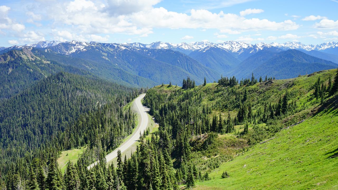
The Numbers: Nearly 1 million acres spanning rainforest, coastline, and mountains. Hurricane Ridge Road climbs 5,242 feet in just 17 miles: that’s a 5.8% average grade that’ll separate the wheat from the chaff in terms of engine performance.
Olympic is like a greatest hits album of Pacific Northwest landscapes, except every track is actually good. You’ve got three distinct ecosystems connected by roads that were clearly designed by someone who understood the assignment. The Hurricane Ridge drive alone gains more elevation than most people’s daily commute covers in total distance.
Starting from sea level near Port Angeles, Hurricane Ridge Road twists upward through old-growth forests that make your car feel like a Hot Wheels toy. The road surface is well-maintained (your suspension will appreciate this), and the curves flow naturally – no awkward engineering here. At the top, you’re rewarded with panoramic views of the Olympic Mountains and, on clear days, the Strait of Juan de Fuca.
The coastal sections offer a completely different driving experience. US-101 hugs the shoreline where you can literally smell the Pacific Ocean through your air vents. Ruby Beach and Rialto Beach provide parking areas where you can let your engine cool while you contemplate how your car insurance probably doesn’t cover tsunami damage. The rainforest sections of the loop road put you under canopies so thick that your automatic headlights might kick in at noon.
Great Basin National Park, Nevada
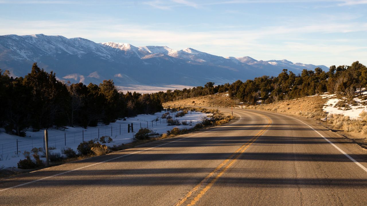
The Numbers: 77,000 acres of high desert isolation, with Wheeler Peak Scenic Drive climbing from 6,825 to 10,161 feet. Only 131,000 annual visitors make this one of America’s least crowded national parks — because apparently, most people prefer waiting in line at Disneyland.
Great Basin is Nevada’s best-kept secret, probably because it requires effort to reach, and most people stop reading at “Nevada desert.” This is a shame because the 12-mile Wheeler Peak Scenic Drive is one of the finest mountain roads you’ve never heard of. It’s paved, well-maintained, and climbs through four distinct life zones, like having four different race tracks in one afternoon.
The drive starts in sagebrush flats that look like every Western movie ever made, then climbs through pinyon pine and juniper forests where the air gets noticeably thinner and your engine starts working harder. Higher up, you’ll encounter aspen groves that turn golden in fall and bristlecone pine groves containing trees that were ancient when Julius Caesar was in diapers.
At the top, Stella Lake provides a perfect spot to park and let your cooling system catch its breath. The silence up here is so complete you can actually hear your engine ticking as it cools down. Wildlife sightings are common: mule deer that seem genuinely puzzled by your presence and golden eagles that probably think your car is some weird, slow-moving prey animal.
The best part? Even during peak season, you might see five other vehicles on the entire drive. It’s like having a private test track, except instead of orange cones, you get million-year-old geological formations.
Lassen Volcanic National Park, California
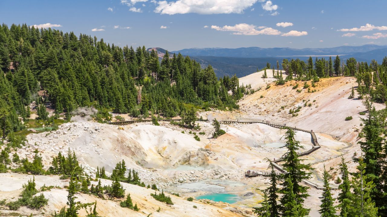
The Numbers: The 30-mile park road reaches 8,512 feet at its highest point, with grades up to 6%. The park sits on four different types of volcanoes — because apparently one type of potential catastrophe wasn’t exciting enough.
Lassen Volcanic is where geology goes to show off, and your car gets a front-row seat to the demonstration. The main park road is like driving through a science textbook, except the illustrations move and occasionally emit steam. You’ll climb past sulfur springs that smell exactly like your buddy’s modified Subaru on a hot day, and crystal-clear lakes that reflect snow-capped peaks like nature’s own chrome.
The road surface varies from freshly paved sections to areas where winter frost heaves have created natural chicanes. Your suspension will get a workout, but nothing your daily driver can’t handle: this isn’t the Baja 1000. Bumpass Hell (yes, that’s the actual name) offers a parking area where you can explore geothermal features that prove the Earth’s core is still very much a work in progress.
Cinder Cone provides a side trip for those brave enough to take their car up a rough road that makes your driveway seem smooth. The payoff is views of the entire park and a chance to see what happens when a volcano has a bad day. Pro tip: This is not the place to test your car’s approach and departure angles unless you enjoy explaining to your insurance company how you got volcanic rock embedded in your undercarriage.
The elevation changes mean your engine will work harder, especially if you’re driving something that remembers when gas was under a dollar per gallon. But the constantly changing scenery keeps things interesting, and the relatively light traffic means you can actually enjoy the drive instead of staring at someone else’s bumper.
Guadalupe Mountains National Park, Texas
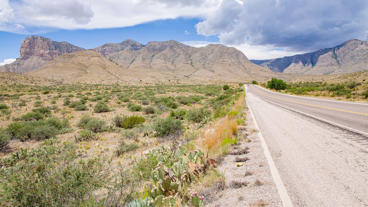
The Numbers: 86,367 acres of high desert, with Guadalupe Peak reaching 8,751 feet – the highest point in Texas. The park receives about 200,000 visitors annually, which is barely a traffic jam in Houston terms.
Guadalupe Mountains rise from the Chihuahuan Desert like Texas-sized evidence that everything really is bigger here. The drive into the park offers wide-open views that make your speedometer seem inadequate and your fuel range suddenly very relevant. This is big country where the horizon isn’t a suggestion, it’s a destination.
The main park road (US-62/180) runs along the base of the mountains, offering constant views of El Capitan, a limestone cliff that makes your local rock climbing gym look like a pebble. The road surface is excellent: this is Texas, where they take their highways seriously, and traffic is usually light enough that you can actually use your cruise control.
McKittrick Canyon road provides a more adventurous driving experience, though “road” might be generous. It’s more like a well-organized collection of gravel and optimism. But for those willing to trust their suspension to the desert gods, the fall colors in McKittrick Canyon rival anything New England has to offer, minus the crowds and overpriced maple syrup.
Wildlife viewing from your car is excellent here. Elk herds cross the road with the casual confidence of locals who know they have the right-of-way. Roadrunners dart across the asphalt like feathered Formula 1 drivers, and mule deer graze roadside with the indifference of creatures who’ve never heard of car insurance claims.
Hoosier National Forest, Indiana
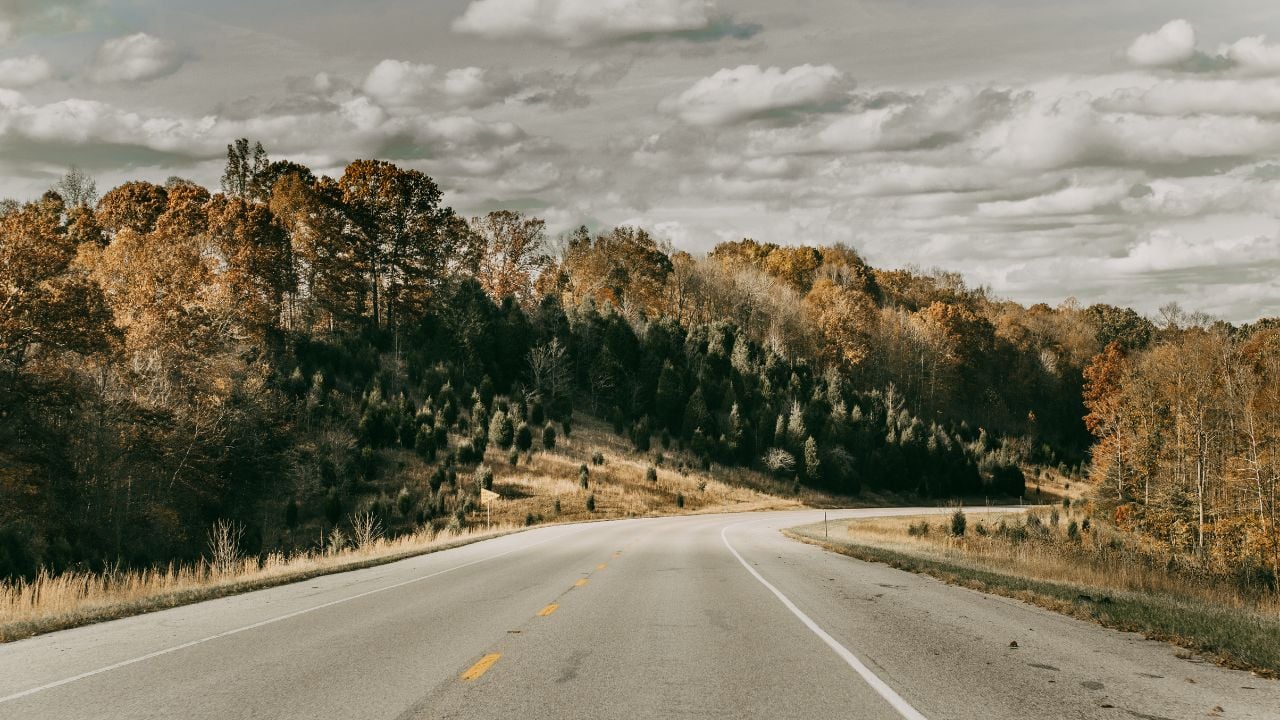
The Numbers: 200,000 acres of rolling hardwood forest spread across southern Indiana’s hills, with scenic byways including the 23-mile Hoosier Hills Scenic Route. Elevations range from 400 to 1,000 feet: not exactly Colorado, but your turbo won’t notice the difference, and your transmission will appreciate the gentle grades.
Hoosier National Forest proves that you don’t need mountain passes to enjoy a good drive – sometimes the best roads are the ones that flow naturally through landscapes that change gradually rather than dramatically. This is driving for people who understand that pleasure doesn’t always require white knuckles and cooling system stress tests.
The forest roads wind through mature hardwood stands where oaks, maples, and hickories create a canopy so thick your GPS might lose signal and your automatic headlights could activate at midday. These aren’t technical driving roads in the alpine sense, but they reward smooth inputs and patience over raw horsepower. Think of it as meditation for your right foot.
Lake Monroe and Patoka Lake provide scenic stopping points where you can park and watch locals launch boats that probably cost more than your car but handle significantly worse in corners. The fishing is reportedly excellent, though your car’s cup holders are better suited for coffee than live bait containers.
Spring brings wildflower displays that carpet the forest floor like nature’s own welcome mat, while autumn transforms the hills into a living postcard that makes New England’s fall foliage tourism industry jealous. The rural roads connecting forest sections offer glimpses of Indiana’s agricultural heritage, where corn fields stretch toward horizons that seem impossibly distant for a state most people think they can drive across during a lunch break.
Wildlife sightings include white-tailed deer that have apparently never heard of right-of-way laws, wild turkeys that strut across asphalt with the confidence of birds that know hunting season is months away, and the occasional raccoon family that treats your headlights like their personal spotlight.
The best part? Gas stations are plentiful, the roads are well-maintained by Midwestern standards (which is to say, they exist and are mostly paved), and you’re never more than 30 minutes from decent barbecue. It’s the perfect destination for drivers who want scenic beauty without the drama of mountain passes or the expense of premium fuel requirements.
Theodore Roosevelt National Park, North Dakota

The Numbers: 70,447 acres of badlands divided into three units, with scenic drives totaling 36 miles. Bison herds number around 400-500, and they have absolutely zero respect for your right-of-way.
Theodore Roosevelt National Park proves that North Dakota has more to offer than just questionable winter weather and college students who think 20 below is “not that cold.” The badlands here look like Mars, if Mars had better road maintenance and fewer rovers.
The scenic loop roads wind through landscapes that change color depending on the time of day and your suspension’s ability to handle washboard sections. The painted layers of rock tell geological stories spanning millions of years, which puts your car’s warranty period in perspective. Bison roam freely and have been known to use the roads as their personal highways, completely ignoring posted speed limits and yield signs.
The South Unit’s 36-mile scenic loop can be driven in about an hour if you’re in a hurry, but that defeats the purpose entirely. This is a landscape that rewards patience and punishes rushing. Prairie dog towns provide entertainment as these rodent comedians pop up and down like furry whack-a-mole games. They’re also apparently fearless critics of your driving skills, chattering commentary from their roadside perches.
Wind Cave’s proximity means you can combine underground exploration with above-ground driving adventures. Just remember that the local wildlife considers your car a large, slow-moving curiosity rather than a threat. Bison traffic jams are real, and your horn won’t intimidate a 2,000-pound animal that views your sedan as a mildly interesting obstacle.
Black Canyon of the Gunnison National Park, Colorado
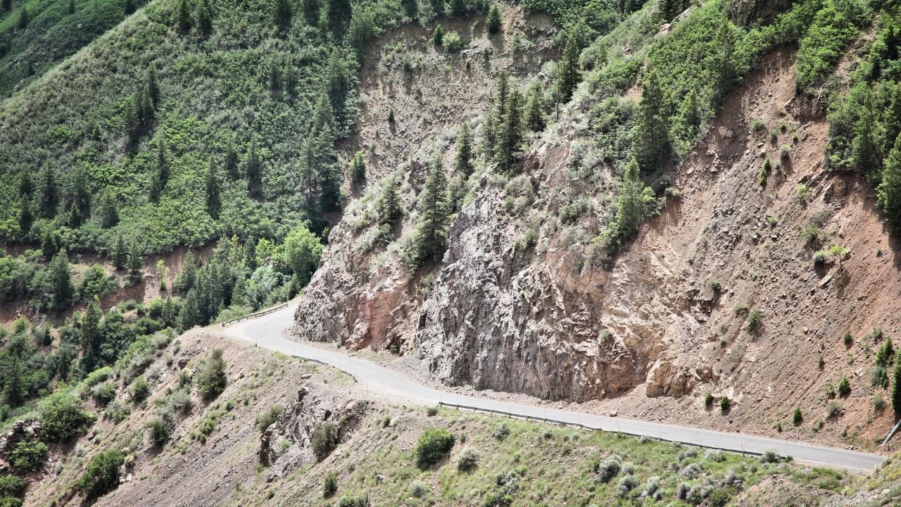
The Numbers: The canyon plunges 2,722 feet at its deepest point, with walls so steep that some areas receive only 33 minutes of sunlight per day. The South Rim Drive stretches 7 miles with 12 overlooks, each offering views that make your parking brake suddenly seem very important.
Black Canyon of the Gunnison is what happens when water decides to cut through rock with the persistence of a mechanic chasing a mysterious engine knock. The resulting gorge is so narrow and deep that standing at the rim makes you appreciate your car’s safety features in entirely new ways.
The South Rim Drive is paved and accessible to all vehicles, though the constant pull toward the canyon edge might make you reconsider that sporty lowered suspension. Each overlook provides parking areas where you can safely exit your vehicle without worrying about becoming part of the geological exhibit. The views are so dramatically vertical that your car’s inclinometer (if it has one) might file a complaint.
The drive itself is relatively easy — no challenging grades or technical sections — but the scenery provides enough distraction to make you grateful for guardrails. The Gunnison River, visible far below, carved this canyon at a rate of one inch per thousand years, which makes your daily traffic delays seem positively speedy.
Wildlife viewing includes golden eagles that circle at eye level when you’re standing at the rim, and mule deer that somehow navigate terrain that would challenge a mountain goat. The night sky here is spectacular enough to justify bringing a blanket and lawn chairs, turning your car into base camp for an impromptu stargazing session.
Shenandoah National Park, Virginia
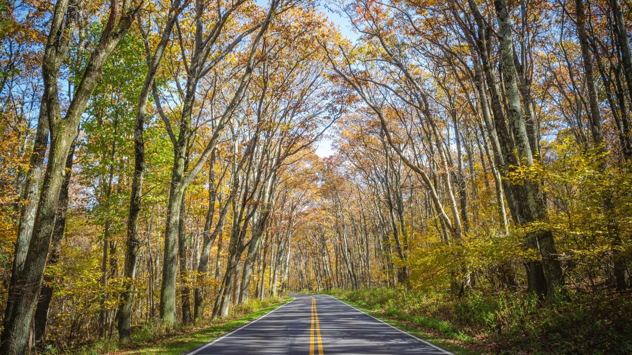
The Numbers: Skyline Drive stretches 105.5 miles along the Blue Ridge crest, with 75 scenic overlooks and a 35 mph speed limit that actually makes sense once you experience the road. Elevation ranges from 550 to 4,051 feet, providing constant grade changes that keep your transmission engaged.
Skyline Drive is America’s answer to the question “What if we built a road specifically for enjoying the drive rather than getting somewhere fast?” This 105-mile ribbon of asphalt follows the ridge line of the Blue Ridge Mountains like it were designed by someone who understood that the journey matters more than the destination.
The road surface is generally excellent — the National Park Service takes maintenance seriously — and the curves flow naturally with the mountain topography. No awkward engineering here, just smooth transitions that let you focus on the scenery instead of fighting your steering wheel. The 35 mph speed limit isn’t just a suggestion; it’s actually the perfect pace for appreciating both the road and the views.
Fall brings the famous autumn colors that cause traffic jams in New England, except here, you can actually move at a reasonable pace. Spring offers blooming dogwoods and redbuds that paint the hillsides in pastels. Summer provides the full green canopy experience, and winter (when the road stays open) offers clear views through bare branches.
Wildlife sightings are common and varied. Black bears occasionally use the road as their personal hiking trail, deer graze at overlooks like they’re posing for tourist photos, and wild turkeys strut across the asphalt with the confidence of birds who know they have federal protection.
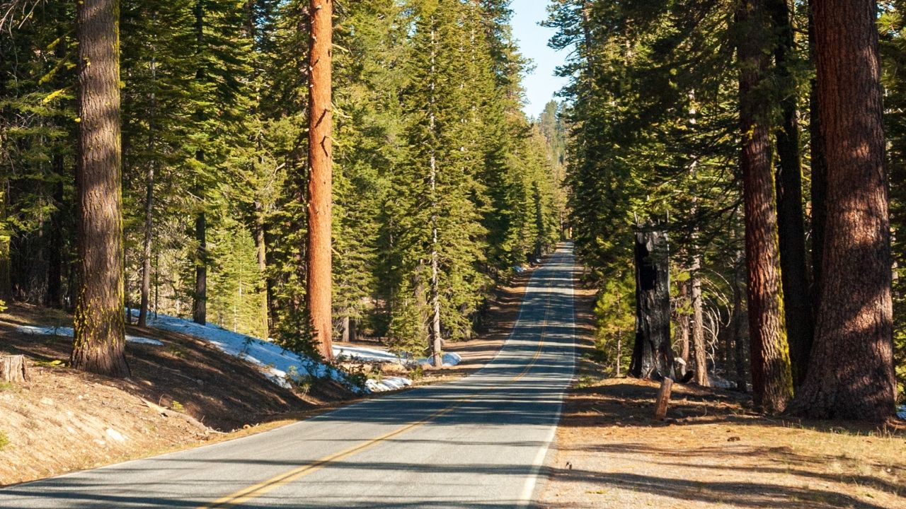
Kings Canyon National Park, California
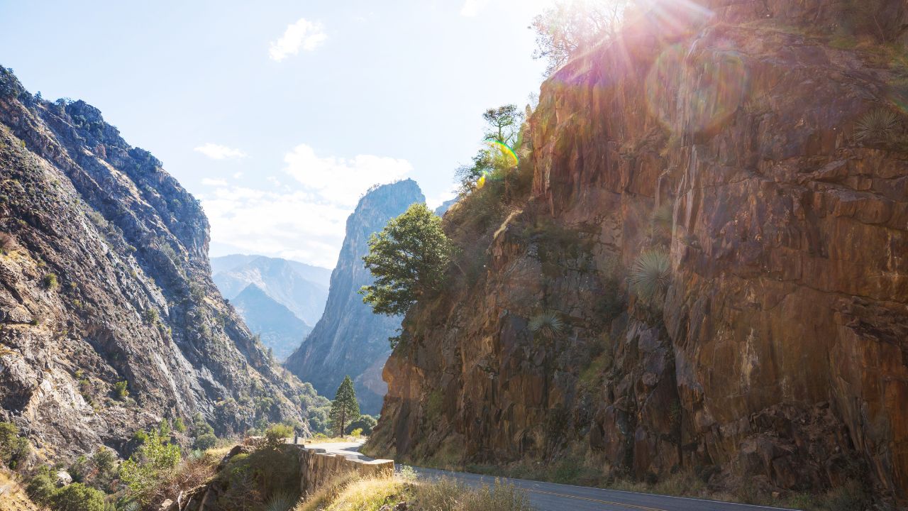
The Numbers: Kings Canyon Scenic Byway descends 4,000 feet over 30 miles into one of North America’s deepest canyons. The road passes through groves containing some of Earth’s largest living things: giant sequoias that make your SUV look like a Matchbox car.
The Kings Canyon Scenic Byway (Highway 180) is a masterclass in road engineering that takes you from mountain meadows down to the canyon floor without requiring a parachute. The descent follows the South Fork of the Kings River, providing a soundtrack of rushing water that’s infinitely better than your car’s sound system.
Giant sequoia groves line portions of the route, where parking areas let you step out and crane your neck at trees that were ancient when your car’s great-great-grandfather was still in the planning stages. These trees put automotive longevity in perspective: your odometer might show 200,000 miles, but these giants have been standing here for over 2,000 years.
The road surface is well-maintained considering the challenging terrain, though some sections remind you why your car has a low gear. Switchbacks are properly engineered with adequate sight lines and run-off areas, unlike some mountain roads that seem designed by people who thought guardrails were optional suggestions.
Zumwalt Meadows provides a peaceful stop where the canyon opens up and the Kings River meanders through grasslands. It’s the perfect place to let your engine cool while you contemplate the geological forces that carved this landscape. Just remember: what goes down must come back up, and the return trip will definitely test your cooling system and your patience with tourists driving 15 mph in a 45 mph zone.
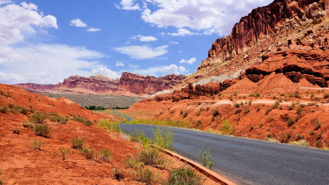
Capitol Reef National Park, Utah
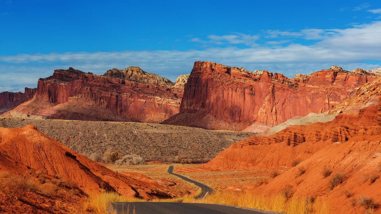
The Numbers: The Scenic Drive extends 8 miles through Capitol Reef itself, while Highway 12 — one of America’s most scenic routes — borders the park. Petroglyphs along the route date back 1,300 years, proving that humans have been enjoying road trips here longer than we’ve had roads.
Capitol Reef is Utah’s best-kept secret, mainly because it requires more effort to reach than the state’s more famous parks. This works in your favor: less crowding means more road to yourself. The park sits along the Waterpocket Fold, a geological wrinkle in the Earth’s crust that creates a landscape so colorful it makes your car’s paint job seem conservative.
The main Scenic Drive is paved and suitable for all vehicles, though the adjacent dirt roads offer adventures for those willing to test their ground clearance and dust tolerance. Red rock formations tower overhead like natural skyscrapers, and the changing light throughout the day creates a constantly shifting art gallery visible through your windshield.
Fruita, the park’s historic district, offers the surreal experience of driving through an orchard oasis surrounded by desert cliffs. During harvest season, you can literally pick apples from trees planted by Mormon pioneers while your car sits parked next to 200-million-year-old rock formations. It’s a reminder that some things change quickly (like your car’s model year) while others remain constant (like the laws of geology and the need for good pie).
Wildlife viewing includes mule deer that browse the orchard like they’re shopping for produce, and desert bighorn sheep that navigate cliffs with the confidence of creatures who’ve never heard of liability insurance. The night sky here is spectacular enough to justify bringing camping chairs and using your car as a windbreak for stargazing sessions.
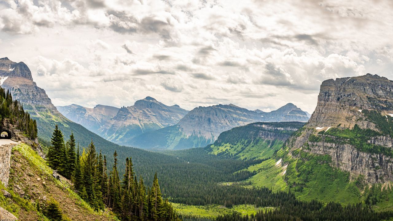
Glacier National Park, Montana
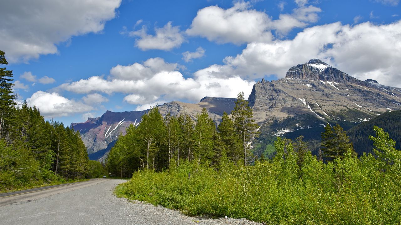
The Numbers: Going-to-the-Sun Road spans 50 miles, climbing to 6,646 feet at Logan Pass. The road is so narrow and winding that vehicles over 21 feet long or 8 feet wide are prohibited: your Miata will fit just fine, but your neighbor’s RV is staying home. Good luck getting it up these hills while using the air conditioning.
Going-to-the-Sun Road is the crown jewel of American mountain driving, an engineering marvel that proves what’s possible when skilled designers meet unlimited scenery. This isn’t just a road; it’s a 50-mile masterpiece that takes you from valley floor to alpine tundra without requiring oxygen masks or sherpa guides.
The drive starts innocuously enough in the valley, but once you begin climbing the western approach, your engine will definitely notice the elevation gain. Switchbacks are properly banked and engineered, though the drop-offs will make you appreciate modern safety equipment. The road clings to cliff faces with the tenacity of a mountain goat, offering views that make your passengers reach for their cameras and their seat belts simultaneously.
Logan Pass, at 6,646 feet, provides parking areas where you can let your engine cool while mountain goats wander the parking lot like they’re checking out your ride. These animals show zero fear of vehicles and have been known to lick salt from car bumpers, apparently considering automobiles mobile salt licks rather than transportation devices.
The road typically opens fully by early July and closes sections by October, making the driving season shorter than your car’s warranty but infinitely more memorable. Snow can fall any month of the year at elevation, so pack accordingly and remember that all-season tires are more of a suggestion than a guarantee at altitude.
Waterfalls cascade down cliff faces directly onto the road in some sections, providing a free car wash that’s infinitely more scenic than your local gas station’s version. Just remember: this is bear country, and both black bears and grizzlies consider the road their personal highway. They have right-of-way, and arguing with a grizzly bear about traffic laws is generally considered poor form.
Ending Driving Toward the Quiet
National parks offer something your daily commute can’t: roads that were built to showcase scenery rather than move traffic efficiently. Driving through these landscapes during peak season brings rewards that outlast any tank of gas. Your car becomes more than transportation: it becomes your ticket to places where the speed limit actually makes sense and the destination is just an excuse for the journey.
These parks invite you to remember why cars were invented in the first place: to expand our horizons beyond what we can reach on foot. Every mile offers chances to connect with landscapes that dwarf our daily concerns and put our mechanical companions in perspective. Whether you’re piloting a pristine classic or a well-worn daily driver, these roads don’t judge — they just deliver experiences that no virtual reality headset can match.
So which park will your odometer visit next? The mountains are calling, and they have excellent cell reception for posting photos that will make your garage-bound friends jealous. Just remember: the quiet roads are waiting, and they don’t care what you drive as long as you show up ready to enjoy the ride.